Heightmap Level Generator: Free Terrain and Heightmaps
github.com · checked 15 Oct 2026
Create terrain in your browser for Unreal, Unity, and Godot with this open-source generator.
How it plugs in
Signal on Game Map Generators7.4#1 of 27
Heightmap Level Generator uses a browser to make procedural terrain and heightmaps for Unreal Engine, Unity, and Godot. Its outputs include 16-bit heightmaps, roads, towns, water features, biome textures, and related export files. You can compare seeds, change settings live, inspect 2D or 3D previews, and export assets for game engines or web workflows. The project is free, MIT licensed, and self-hostable.
Review
In a line
This open-source web application generates procedural maps and heightmaps for Unreal Engine, Unity, and Godot at no cost.
What it does
The generator can form hills, mountains, cliffs, erosion, rivers, lakes, and a raised border ring. Four biome choices are available: temperate, steppe, desert, and snow world.
You can alter parameters as the terrain updates, compare twelve seeds, inspect either a top-down map or illuminated 3D mesh, and walk through the result in first person. A seed and its settings can reproduce the same terrain.
Roads connect towns and map exits, avoid steep slopes and water where possible, and use grades and raised embankments for crossings. Each biome has six automatic texture layers, whose albedo and normal images you can replace.
How it connects
The tool can write Unreal landscape, Unity terrain, Godot Terrain3D, and web or three.js outputs. Depending on the export, files may contain 16-bit PNG or RAW heightmaps, splatmaps, masks, water levels, color maps, layout JSON, glTF meshes, and metadata JSON.
For downstream automation, road, town, and water masks can be paired with layout JSON in PCG, Houdini, or custom placement scripts. No network API or SDK is documented; source code and exported files provide the extension points.
The repository is MIT licensed, so the code can be used commercially. Exported heightmaps, masks, layouts, and meshes belong to you without conditions. You can save and load JSON, undo and redo edits, use presets, and share settings through URLs.
Good fit
This suits game developers and technical artists who need repeatable terrain for Unreal, Unity, or Godot, especially when roads, towns, water masks, or biome layers are part of the map workflow.
It is also useful for comparing terrain ideas quickly in a browser or exporting meshes and data for web projects.
Watch for
The hosted version needs WebGPU. Older browsers or devices without WebGPU will not run it.
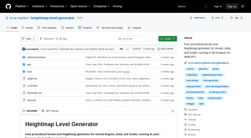
To run it locally, use Node.js with a WebGPU-capable browser, then run npm install and npm run dev. The Windows start.bat script runs the setup. The npm package is private and marked version 0.1.0.
At the default scale, a 512 m map yields a 1024×1024 heightmap at 0.5 m per pixel; the range can extend to 2560×2560 at 1280 m. Check your engine and workflow before relying on a specific export or resolution.
Pricing
Heightmap Level Generator is free to use. Its browser Free plan runs without installation or an account.
You can also self-host the open-source project. The MIT license permits commercial use of the source and exported assets.
Verdict
Choose this tool if you want a no-cost way to shape repeatable terrain, roads, towns, and water data before bringing a map into a game engine. Its multiple export types and editable masks make it suitable for workflows that continue in Houdini, PCG tools, or custom scripts.
Avoid committing to it when your computer or browser lacks WebGPU, or when you need a documented online API or SDK. Local setup also involves Node.js and command-line steps, so hosted browser use is the simpler route.
Our take
Heightmap Level Generator is a practical option for creators who need procedural maps without paying for a license or creating an account. It combines terrain shaping, road and town layout, biome textures, and engine exports, while its MIT code supports self-hosting and commercial projects. Key considerations are hardware and browser compatibility because online generation depends on WebGPU, along with the absence of a published API or SDK. Teams should also confirm that the selected export, map size, and mask files fit their existing pipeline.
- Free browser plan with no account or installation
- Open-source MIT license allows commercial use
- Exports can target Unreal landscape, Unity terrain, Godot Terrain3D, or web workflows
- Repeatable seeds and live editing with 2D, 3D, and first-person views
- Road, town, and water masks plus layout JSON can feed automation
- Hosted use requires a WebGPU-capable desktop browser
- Local setup needs Node.js, npm commands, and a compatible browser
- No documented network API or SDK
- Package is private and listed as version 0.1.0
- Pick it ifGame developers making repeatable terrain for Unreal, Unity, or Godot; Workflows needing road, town, water masks, or layout JSON; Creators wanting a free, self-hostable terrain generator
- Skip it ifYour computer or browser cannot run WebGPU; You need a published online API or SDK; Your pipeline cannot use the listed export formats
Pricing
The browser Free plan has no charge and needs neither installation nor an account. Self-hosting is also available from the MIT-licensed source.
- Freebrowser-based generator · no install · no accountFree
As github.com lists them, checked 15 Oct 2026.
Questions
Does Heightmap Level Generator have a free option?
Yes. The browser-based Free plan has no charge and requires neither installation nor an account.
Which game engines can use its exports?
Its export targets are Unreal landscape, Unity terrain, Godot Terrain3D, and web or three.js workflows.
What browsers are supported?
The hosted tool needs WebGPU; listed choices include desktop Chrome or Edge 113+, Safari 26+, and Firefox 141+ on Windows.
Is local installation supported?
Yes. Run it locally with Node.js, a WebGPU-capable browser, npm install, and npm run dev. Windows also includes a start.bat launcher.
Does it have an API or SDK?
The published material describes no network API or SDK. Extensibility comes through the open-source code and exported files.
Which export files are available?
Possible exports include 16-bit PNG or RAW heightmaps, splatmaps, masks, water and color maps, layout and metadata JSON, and glTF meshes.
May exported assets be used commercially?
Yes. The MIT license permits commercial use, and the project states that exported heightmaps, masks, layouts, and meshes belong to the user without conditions.