Sheltera Software Review
sheltera.ai · checked 10 Oct 2026
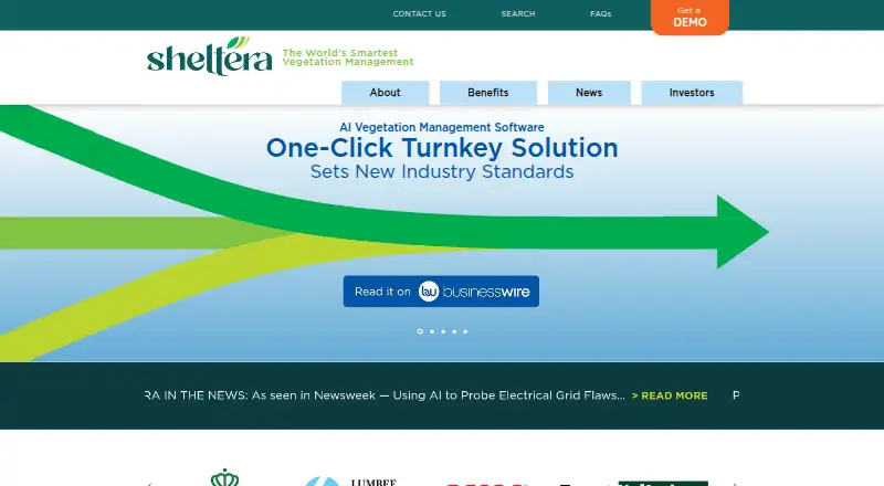
AI vegetation management software that helps infrastructure teams find and prioritize tree threats.
How it plugs in
Signal on Tree Service Software5.5#22 of 27
Sheltera uses detailed multispectral satellite data, LiDAR, and its own AI to spot vegetation hazards along infrastructure. Utilities and other operators can review threats on heat maps, assign Threat Codes, build estimates, and document field work through a mobile app. It runs on Android, iOS, Windows, and self-hosted deployments. Prospective customers must request pricing.
Review
In a line
Utilities and other infrastructure operators can use Sheltera’s AI software to manage vegetation. It identifies tree threats near infrastructure and helps teams plan and document the work.
What it does
Sheltera examines multispectral satellite data, LiDAR, and proprietary AI to find vegetation hazards. Assessments can be adapted to a utility’s requirements, and the company reports 95% accuracy in threat identification.
Teams can use a heat map and Threat Codes to order tree clusters by priority. The system’s Code 5 designation signals an immediate concern. The office tools include job bidding, resource planning, and Street View images.
Field crews use the mobile app for GPS guidance, work orders, estimates and bids, before-and-after images, and completed-job records. Sheltera says dated field entries may help address liability and show compliance with local codes.
How it connects
The mobile app lists Android, iOS, and Windows support. The software may be deployed offline or on a customer’s premises, and Sheltera’s FAQ says it does not retain customer information on its own servers.
A password-protected Dropbox transfer lets the customer team and Sheltera GIS staff exchange files. Sheltera’s FAQ also says the software meets NERC CIP and GSPR requirements.
Good fit
Utilities, municipalities, rural electric cooperatives, railways, and forestry services are among the described users. It suits teams that need to survey large grids, rank vegetation risks, send crews out, and keep field records.
The company says a full grid can be surveyed in days or weeks instead of months. It also says that, on average, 19 of 20 flagged issues are confirmed on the ground.
Watch for
The company does not post a fixed price and invites prospective customers to request a demo.
Accuracy and survey-speed figures are Sheltera’s stated claims. Confirm the assessment scope, deployment setup, file-transfer process, and compliance needs for your organization before committing.
Pricing
Sheltera offers its software on a paid basis and gives pricing by quotation. The site lists a Pricing page, but no accessible amounts are provided. A demo request is the stated path for prospective customers.
Verdict
Choose Sheltera if your organization manages vegetation around utility or other infrastructure and needs satellite- and LiDAR-based threat detection, crew prioritization, estimates, and mobile documentation.
It may fit organizations that require offline or on-premises deployment and stated NERC CIP and GSPR compliance. Ask for a quote and confirm system connections, data handling, and the exact assessment coverage before signing.
Our take
Sheltera fits infrastructure operators that need a dedicated way to detect vegetation threats, rank them, dispatch work, and keep dated field evidence. Its Android, iOS, Windows, offline, and on-premises options support different operating environments. Sheltera also presents its accuracy and survey-time figures as company claims, so buyers should validate them against their own territory and compliance requirements during the demo process.
- Multispectral satellite data, LiDAR, and AI help identify vegetation hazards
- Heat maps paired with Threat Codes support tree-cluster prioritization
- The field app handles navigation, work orders, estimates, and photos
- Supports Android, iOS, Windows, offline, and on-premises deployment
- Time-stamped records support liability and code documentation
- The company quotes prices on request
- Accuracy and survey-speed figures are Sheltera’s stated claims
- Files are exchanged through a password-protected Dropbox link
- Pick it ifUtilities and infrastructure operators managing vegetation risk; Teams needing field work orders and dated documentation; Organizations requiring offline or on-premises deployment
- Skip it ifYou need published pricing before speaking with sales; Your work is outside utilities or other infrastructure operations
Pricing
Sheltera charges for its software but does not publish plan amounts. Prospective customers are invited to request a demo for a quote.
Questions
What is Sheltera used for?
Sheltera finds vegetation hazards near infrastructure and supports prioritization, estimates, assignments, and documentation for tree-related work.
Which devices support Sheltera’s mobile app?
Android, iOS, and Windows operating systems are named in the FAQ.
Can Sheltera run without an internet connection?
The FAQ says the software can be installed offline or on customer premises.
Does Sheltera store customer information on its servers?
Sheltera’s FAQ says customer information is not retained on its servers.
How does Sheltera transfer files?
Files can be exchanged through a password-protected Dropbox link available to the customer team and Sheltera GIS staff.
How much does Sheltera cost?
The software is sold commercially, with quotes supplied on request. The available pricing page does not provide accessible amounts.
Who does Sheltera target?
The company describes use by utilities, municipalities, rural electric cooperatives, railways, and forestry services.
What compliance does Sheltera state?
Sheltera’s FAQ states that its software is NERC CIP and GSPR compliant.
Near it
All alternatives →- RCRoots CRM#21 on this board
- FUForester UVM#23 on this board
- AP
 Arb Pro#20 on this board
- AArboStar#24 on this board
- A
 Arborgold#19 on this board
- A
 ArboristDesk#25 on this board
- CU
 Clearion UVM#18 on this board
- T
 TreeOS#26 on this board
- UVUDC Vegetation Management#17 on this board
- MSMyArborPro Survey App#27 on this board