
Felt GIS: Features, Integrations, Plans and Limits
felt.com · checked 14 Oct 2026
Felt helps teams turn spatial data into collaborative maps, dashboards and apps in the cloud.
How it plugs in
Signal on GIS Software6.7#2 of 64
This browser GIS handles common spatial files, database and cloud connections, and live collaboration. Its Field App for iOS and Android records GPS data, works without connectivity and syncs later. Higher tiers add SQL, dashboards, REST API access, SDKs, embeds and self-hosted deployment options.
Review
In a line
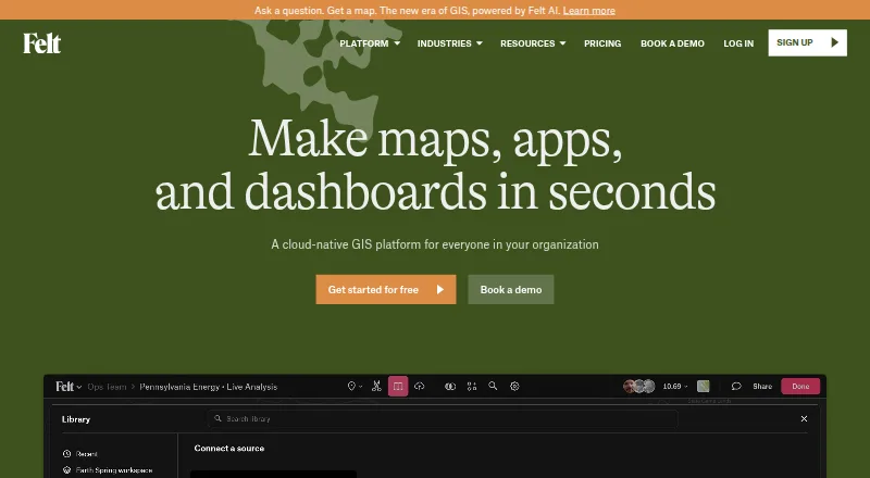
Felt brings map creation, analysis, collaboration and sharing into a cloud GIS. The main interface is web-based, complemented by iOS and Android field apps.
What it does
Spatial uploads include CSV, Excel, GeoJSON, GeoPackage, Shapefile, File Geodatabase, KML/KMZ and GeoTIFF. Felt provides map editing, spatial analysis, SQL, geocoding, drive-time areas and H3 hexagon analysis.
Felt dashboards can show statistics, bar or line charts, histograms, time series, filters, H3 views and viewer interactions. Teams can edit maps together, use live cursors, leave threaded comments, share projects and set permissions.
The Field App supports GPS capture, custom forms, geotagged photos, comments and office synchronization. Business and Enterprise users can save map areas locally, collect data without connectivity, then synchronize after reconnecting.
How it connects
Felt documents connections for Postgres/PostGIS, Snowflake, Databricks, BigQuery, Amazon S3, Redshift, Google Cloud, Azure, Esri, STAC, WFS and WMTS. Team and higher plans can also refresh Google Sheets, Airtable, ArcGIS, SharePoint and other listed sources. Its QGIS plugin carries styling, symbology and layer structure into published maps.
Maps and dashboards can appear in Power BI, Notion, WordPress, SharePoint, Tableau, Retool and other websites. Enterprise lists a REST API and JavaScript SDK; Felt also documents a Python client, webhooks and extensions. Felt AI can build maps, write SQL and create HTML popups, while its MCP endpoint lets Claude, ChatGPT, Gemini and Copilot query permitted data.
Felt is a proprietary hosted product, not open source. Enterprise includes regional deployment options and makes self-hosting available. GIS software and interactive map software are useful categories for comparing similar tools.
Good fit
Felt is aimed at GIS, field operations, data science, analytics, product and engineering teams. It is useful for collaborative mapping, spatial analysis, dashboards, field surveys and publishing maps inside other services.
It can handle large or multi-gigabyte datasets, supports custom branding and role-based access, and provides live data refresh options.
Watch for
Felt is not open source. Its authentication choices do not include native two-factor login, although password, Google and enterprise SAML SSO sign-in are supported.
Reviewers mention a learning curve for people accustomed to CAD or Bluebeam, along with missing workspace measuring and calculation features and problems in some S3 filename and large-dataset workflows. Check those needs before choosing it.
Plan limits vary for seats, viewers, processing, map views, refresh timing, offline work and developer features. Felt says U.S. hosting is the default; enterprise arrangements add regional hosting, data residency and customer VPC options.
Pricing
The Personal tier remains free for unlimited maps and sharing, but excludes personal data-file uploads and business use. The Free tier also has no charge forever and provides 3 seats, 25 viewers, 10k map views per month, maps, annotations, real-time collaboration and public sharing.
Team is $199 a month on annual billing, or $249/month with monthly billing. It includes 3 seats, 25 viewers, 5 GB processing per month, 25k views, daily Sheets/ArcGIS/SharePoint refresh, forms, photos and 250 AI credits.
Business is $599 a month with annual billing, or $749/month monthly. It includes 5 seats, 100 viewers, one database or bucket, hourly refresh, 25 GB processing, 100k views, SQL, dashboards, drive times, offline maps, REST API, extensions and 1,000 AI credits.
Annual Platform billing is $1,000 a month, compared with $1,250/month monthly; it adds the JavaScript SDK and authenticated embeds, and customer users need no Felt accounts or seats. Enterprise begins at $1,250/month paid yearly and includes 10 seats, unlimited viewers and databases, 15-minute refresh, SSO/SAML, regional or self-hosted deployment, SLA, 100 GB processing, 250k views and 2,500 AI credits. Professional requires an annual contract; pricing is unpublished, with 10 full seats, unlimited free viewers, 25 GB processing, 100K views, onboarding and a 7-day trial.
Verdict
Choose Felt if your team needs shared web maps, spatial analysis, dashboards or field collection tied to cloud data. Its integrations, embeds and developer tools make it suitable for organizations building mapping workflows into other products.
The free options cover personal use and small public projects. Paid plans become relevant for offline field work, database connections, SQL, APIs, SDKs, higher limits or enterprise hosting. Avoid committing without checking the missing two-factor login, plan limits and any CAD-style workspace requirements. Map creation software offers another comparison point.
Our take
Felt is a sensible choice for teams that want browser-based GIS without giving up database connections, collaborative editing or embedded maps. The free plans provide a way to make and share maps, while paid tiers add analysis, dashboards, offline field work, APIs and SDKs. Enterprise plans add SSO, regional or self-hosted deployment and higher limits. It is less suitable for organizations that need open-source software, native two-factor authentication or specialized CAD-style measuring tools. Review each plan’s seats, viewers, processing and map-view allowances before signing an annual contract.
- Supports real-time map editing, comments and permission controls
- Connects to databases, cloud storage, GIS services and spreadsheets
- Mobile field app supports GPS capture, forms, photos and offline sync
- Maps and dashboards support embedding in business tools
- Includes REST API and JavaScript SDK on listed plans, with a documented Python client
- Proprietary product rather than open-source software
- Authentication does not include native two-factor login
- Some plans cap processing, viewers, seats and monthly map views
- Some reviewers report S3 workflow and workspace-tool limitations
- Professional pricing is not published
- Pick it ifGIS and operations teams building shared web maps; Field surveys with mobile GPS capture and offline work; Teams embedding dashboards or maps in other products
- Skip it ifYou need open-source GIS software; You need native two-factor authentication; Your workflow relies on CAD-style measuring and calculation features
Pricing
A free personal tier and free shared-map tier are available. Professional pricing is unpublished and annual. A 7-day trial is listed for Professional.
- PersonalFree, forever · Unlimited maps and sharing · No own data file uploads · Personal use only, not businessFree
- Freefree forever · 3 seats · 25 viewers · 10k map views/month · maps, annotations, real-time collaboration and public sharingFree
- Teamannual billing; $249/month monthly billing · 3 seats · 25 viewers · 5 GB processing/month · 25k views/month · daily Sheets/ArcGIS/SharePoint refresh · forms and photos · 250 AI credits/month$199/mo
- Businessannual billing; $749/month monthly billing · 5 seats · 100 viewers · 1 database or bucket · hourly refresh · 25 GB processing/month · 100k views/month · SQL, dashboards, drive times, offline maps, REST API, extensions and 1,000 AI credits/month$599/mo
- Platformannual billing; $1,250/month monthly billing · JavaScript SDK and authenticated embeds · customer users need no Felt accounts or seats · free for first three months with a paid plan$1,000/mo
- Enterprisefrom $1,250/month paid yearly · 10 seats · unlimited viewers · unlimited databases · 15-minute refresh · SSO/SAML · regional or self-hosted deployment · SLA · 100 GB processing/month · 250k views/month · 2,500 AI credits/month$1,250/mo
- ProfessionalAnnual contract; price not published · 10 full seats · Unlimited free viewers · 25 GB monthly data processing · 100K monthly map views · 1-hour onboarding · 7-day trialOn request
As felt.com lists them, checked 28 Sept 2026.
Questions
Is a free Felt plan available?
Yes. The Personal tier is free forever for personal use, while Free is also free forever and includes 3 seats, 25 viewers and 10k map views per month.
Can Felt work offline?
Business and Enterprise users can download map areas, gather features, forms, photos and comments without a connection, then sync the work after reconnecting.
Which data sources connect to Felt?
Felt lists Postgres/PostGIS, Snowflake, Databricks, BigQuery, Amazon S3, Redshift, Google Cloud, Azure, Esri, STAC, WFS and WMTS, along with other refresh sources on higher plans.
What developer API options does Felt provide?
Business and Enterprise include the REST API. Felt also documents JavaScript and Python SDKs, webhooks and map extensions.
Where is Felt hosted?
Felt says U.S. hosting is the default. Enterprise options include regional hosting, data residency choices and customer VPC deployment.
Does Felt support two-factor authentication?
Felt supports password, Google and enterprise SAML SSO login, but it does not provide its own built-in two-factor authentication.